USA – Southwest 1
In the depths of the system
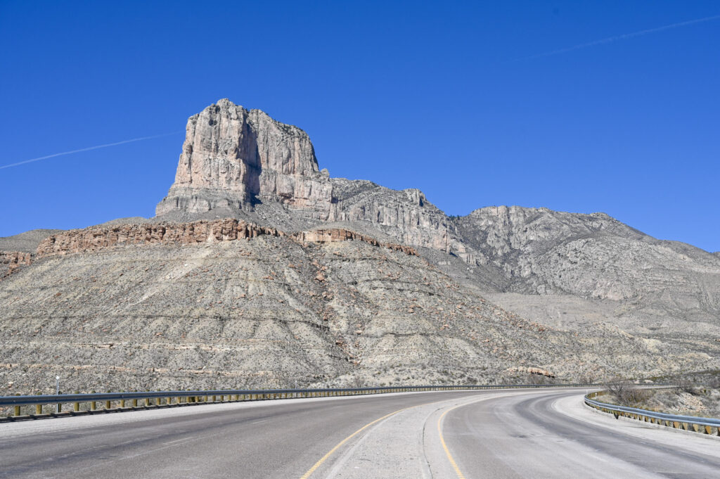
The Carlsbad Caverns is one of more than 300 limestone caves in a fossil reef created by an inland sea about 265 million years ago. If you drive through the area and see the mountain range of the Guadalupe Mountains, you would never get the idea that there is a huge cave system underneath. Carlsbad Caverns National Park covers an area of 18,925 hectares. There are only 120 caves of the park explored and there are more to come, depending on the research.

Thanks to a time jump (we can set the clocks back an hour as we cross the border to New Mexico) we arrive just in time at the caves and are lucky that we still have tickets sold (until 2 pm). Fifteen minutes later, it would have been too late. Because the caves to be visited are so large (you have to calculate about three hours), no tickets will be sold after 2:15 pm. Otherwise, you will not be able to see everything, that would be a pity. Unfortunately, there are no more guided tours around this time of day. Instead, we are allowed to explore the caves alone by audio guide.
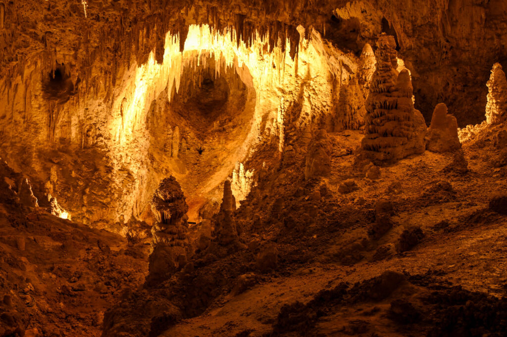
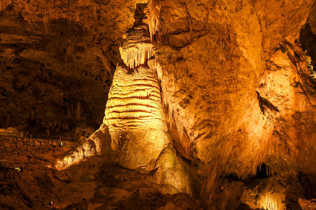
First, we take a look at the exhibition at the Visitor Center to get an impression of the entire extent of the Carlsbad Caverns and surrounding caves and their origins. Afterwards we take the natural entrance to the cave, which is absolutely recommended (lazy ones can also take the elevator down). The path is paved throughout with a grippy surface, even in the cave itself. With a few photo stops, the descent into the large main room (Big Room) does not take quite an hour. Wow, the sheer size of this room is indescribable! It is the largest single cave chamber in North America by volume and measures about 3.3 ha (that’s, I think, about 5 football fields). Stalagmites and stalactites in a wide variety of shapes as far as the eye can see. We follow the big tour, where you can see practically everything that is open to the public, except for four rooms. These can only be visited in connection with a guided ranger tour. However, we don’t feel like we missed anything, because as soon as we get around a corner the formations are even prettier than the previous ones. With numerous photo stops we need about two hours for the tour in the cave itself. The return is then by elevator only, as the whole tour is laid out as one-way.


Those who come to the Carlsbad Caverns between mid-May and the end of October can experience the spectacle of the nightly bat flights. Thousands of Mexican Bulldog Bats fly out at dusk to search for food (insects, no human hair!). Certainly a natural spectacle unparalleled.
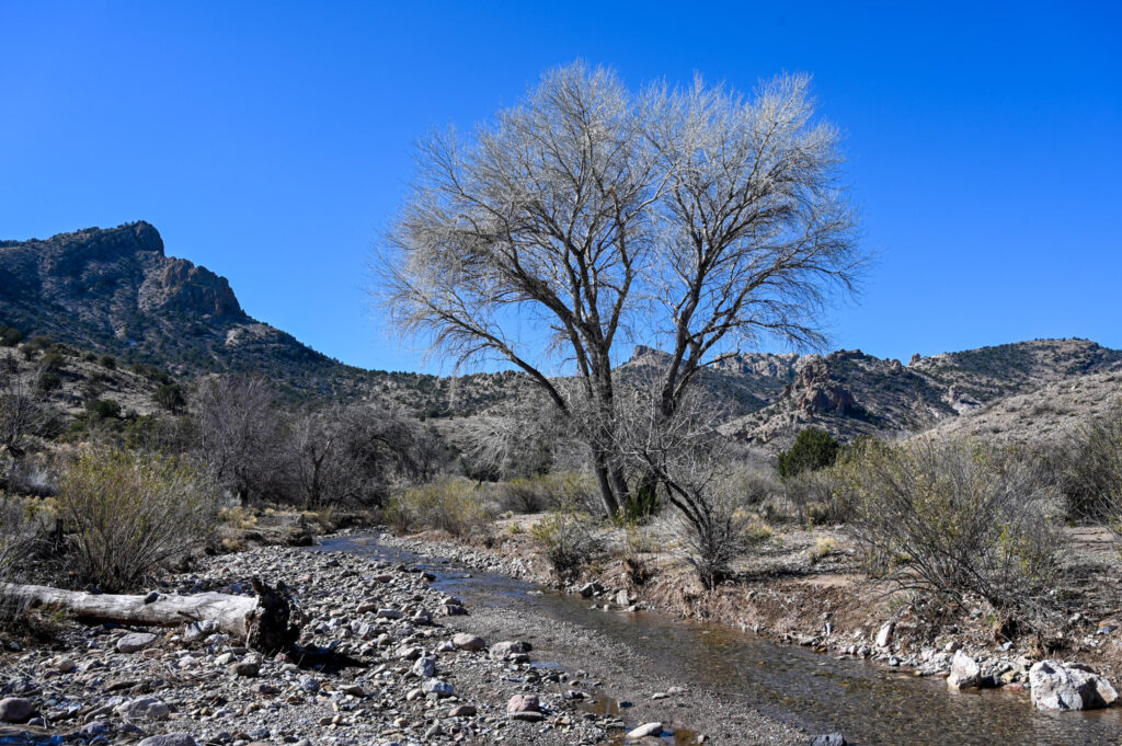
Around the Carlsbad Caverns there is enough BLM-Land to stay overnight. We choose a place on a hill. By day, the barren vegetation seems deserted. But as it gets dark, a huge sea of lights spreads beneath us. Occasionally we also see pilot flames. Greetings from the gas and oil industry…
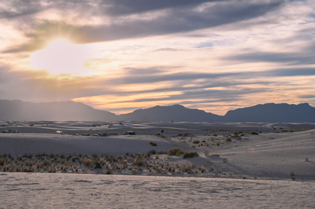
White Sands National Park
We choose the road via Artesia to White Sands National Park. We ignore Roswell (everyone knows that aliens are there) to get more directly to our next destination. For this we drive over a small pass. We are surprised when we see a (really) small ski resort in Cloudcroft, that is actually open, which seems to occur about twice in 5 years. The crazy thing is that the Chihuahua Desert is about 1,300 meters down in the valley. After a bit of snow under our shoes, we arrive at White Sands National Park (only designated a national park in 2019).
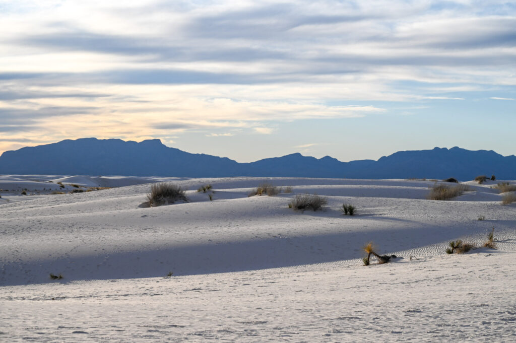
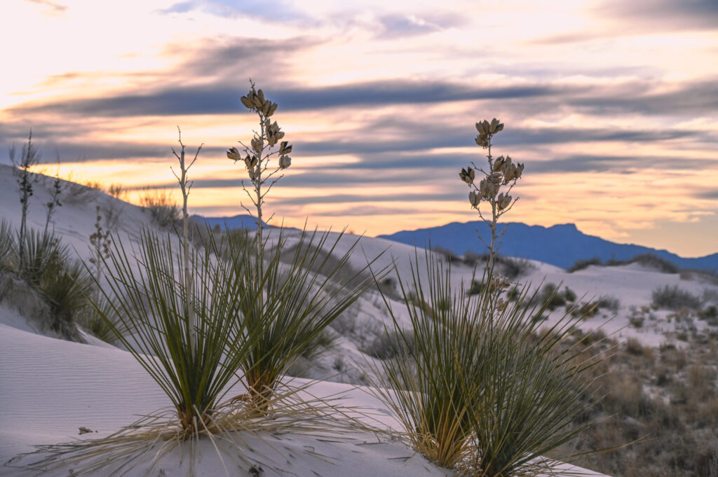
The special thing about this park are the snow-white dunes made of gypsum, which by the way are the largest of their kind in the world. They owe their existence to the nearby mountains. From there, gypsum dissolved in the water enters Lake Lucero, which is located in the far east of the park. When the water evaporates, selenite crystals remain, which are crushed by the wind until they are as fine as sand. What prevents the sand from being blown away by the wind is the groundwater. The groundwater level in White Sands is relatively high and the water keeps the dunes moist all year round. Thus, not all the sand is blown away and dunes are formed. Groundwater also allows life in this desert. Each plant has its own survival strategy. So there are some who let their roots grow to groundwater. When water is absorbed, a little of it also enters the surrounding sand and a kind of pedestal forms around the plant. As the dune continues to drift, the pedestal becomes visible. This in turn offers accommodation for the kit fox. If you have time, you should join a ranger walk. Together with a ranger you can walk across the dunes, pick up selenite crystals and marvel at the beauty of the dunes. On the dunes you can also wonderfully capture the sunset photographically.
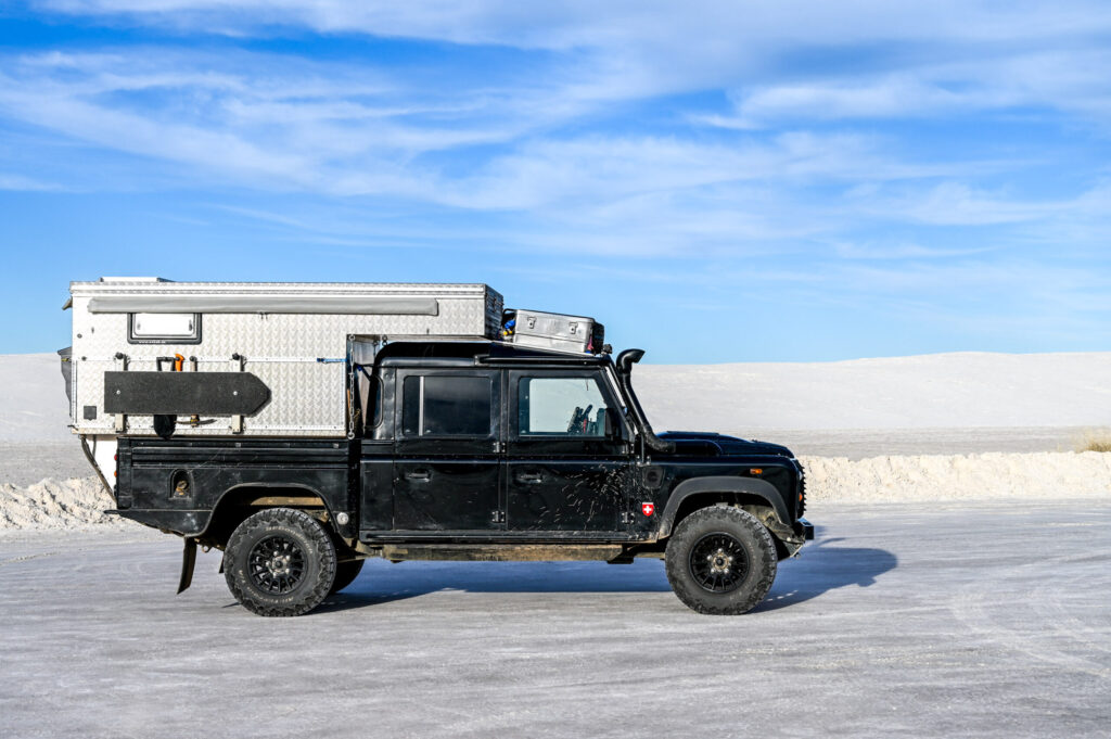

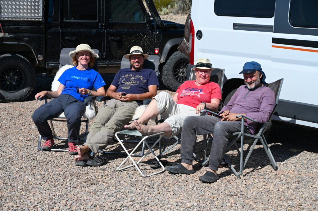
In one of the parking lots in the park we discovered a campervan with Swiss license plates. The associated travellers are Gaby and Cornel. They started the Panamericana from the south and are now on their way home. We agree to have dinner together. Actually we wanted to stay at the Visitor Center parking lot, but this is not allowed. We find another place, chat and exchange our experiences until the early morning hours. Since the four of us still have so much to talk about, we decide to spend a leisurely day in the nearby Oliver Lee State Park. What a good idea! The weather is beautiful, as is the location of the State Park with views over the valley and the White Sands in the distance. We get great tips from Gaby and Cornel, not only in terms of South America but also for the USA, which they have already travelled several times. Thank you very much!
Since we have very different paths, we say goodbye to our new friends after a feudal breakfast. Not far from White Sands is the US Air Force’s missile test range, which can be visited. Unfortunately, as of late for U.S. military personnel or U.S. citizens only. Since we are neither, we march off a little disappointed.

Cave dwellers and open pit mining near Silver City
In Las Cruces we want to have a crack repaired our Defender has on the exhaust pipe. USD 25.00 and three hours later we leave again. The exhaust pipe is welded and hopefully lasts. It’s getting dark and we’ll find a beautiful pitch amidst creosot bushes in the Organ Mountains-Desert Peaks National Monument.
Our path leads us through gently hilly landscape with streams, small canyons and trees. In the distance we can see sugared mountains. A nice change after the prairie landscape of the last days. We visit the Gila Cliff Dwellings National Monument. These are caves in Cliff Dweller Canyon where the Mogollen people lived around the 13th century. There is a short tour where we can also enter the caves. The remains of the walls built by the Mogollen are still visible.


On a beautifully winding mountain road through dense forests with small streams we arrive in Silver City. Big time hungry we are looking for a good place to eat and find something in Little Toad Creek Brewery. Guess who we see there again? Babs and Helmut (who we met at the Mission San José in San Antonio)! How wonderful!
For us, Silver City is just a stopover and we want to move further west. On the outskirts along the road we then see hugely stacked earth walls in different shades. We find out that this is a remnant of a decommissioned mine. Actually, it would be cool to visit an active open pit mine. Ha…! In fact, near Tucson you can visit an active copper open pit mine. We book tickets and dash away.
From the Visitor Center of the mine the bus runs through the mine area to an observation deck. From there we have a good overview of the mine. It is 4 km long and just as wide… You can see the giant dumpers going up and down and how they get rid of the ore in the crusher. The whole thing is impressive! But you also have thoughts about what we do with Mother Nature just to get minerals… Next, we can look at the stone mill and see how the copper minerals are dissolved from the ore meal by means of a chemical and water bath. After this process, the dried product contains only 28% copper. This is forwarded to a warehouse, from where it is transported by truck to the smelter, 130 km away, for further processing.


Saguaro National Park
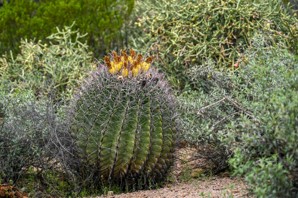
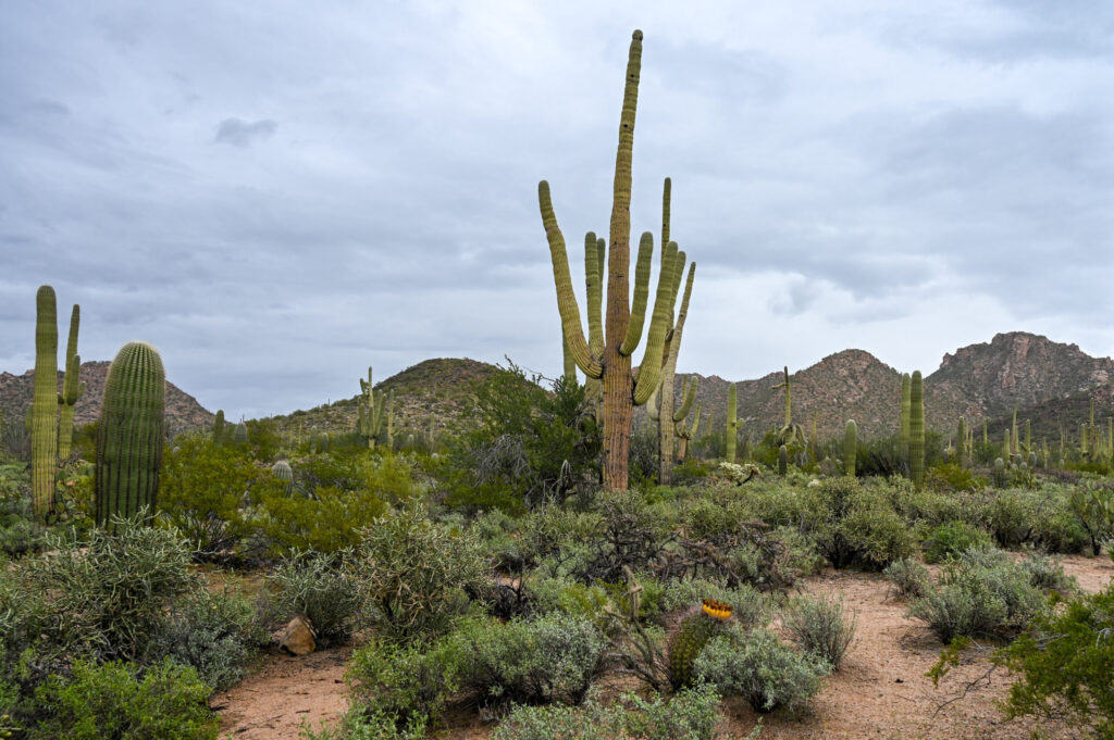
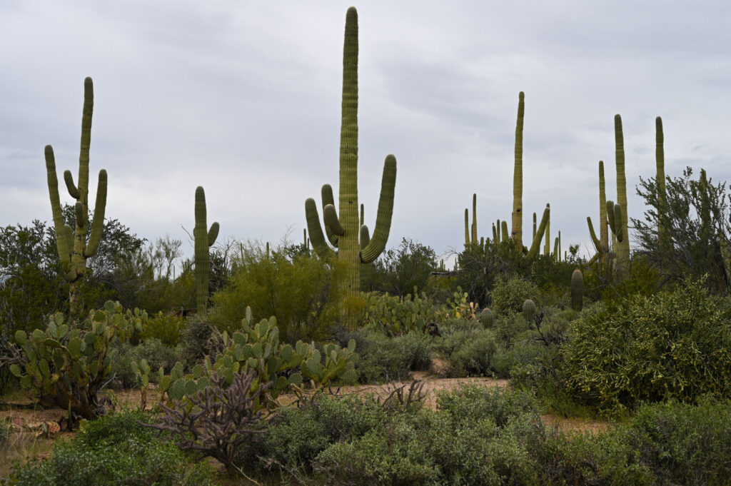
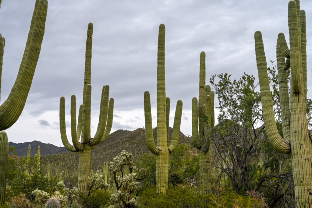
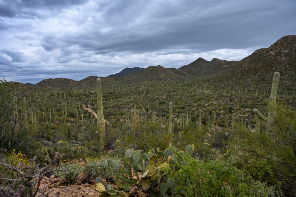
We are in the Sonoran Desert, one of the most diverse and species-rich deserts in the world. It is home to the Saguaros (pronounced sah-WAH-ro) and many other cacti species. The giant cacti are strictly protected and are particularly numerous in the Saguaro National Park. A Saguaro can live up to 200 years. It is only at about 75 years of age that the arms begin to grow. They are impressive plants, from huge (and therefore probably quite old) to small (and therefore rather whippersnappers) everything is represented. The surrounding hills are littered with the giants, so is the plain below us. Since it has rained recently, we can experience the Sonora in almost full bloom. The plants and cacti bloom in different colours. There are even trees with green birch. The Saguaro National Park is also home to numerous animals (the rattlesnakes are fortunately still sleeping :-)). The Saguaros themselves also provide shelter for birds. The holes you see in the cacti are their front doors.
It is also exciting to see that the Saguaros are not hollow inside. Behind the green facade lies a kind of wooden scaffolding. It looks like thin rods have been glued together. When a cactus dies, you can see the scaffolding underneath it very well. The Native Americans used the skeleton of the Saguaro to build roofs, walls, and even furniture. They also made long spears (kuipad) with which they harvested the fruits of the giant cacti.

Probably the most beautiful place in the southwest
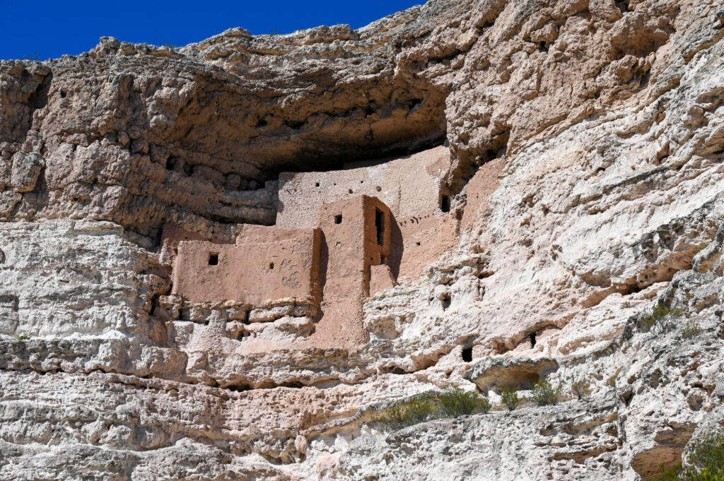
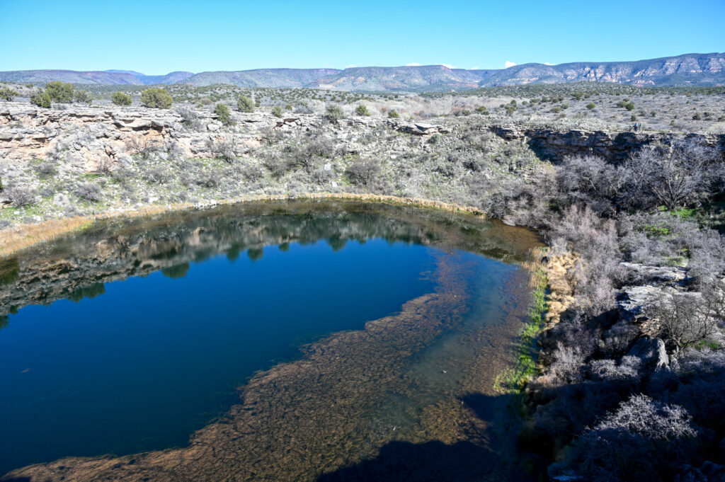
Before we visit arguably the most beautiful place in the southwest, we visit the Montezuma Castle National Monument (the Sinagua Indians carved into the rock in the 12th century) and the Montezuma Well National Monument. The latter is quite exciting, since the “source” consists of a huge limestone hole, which is fed by an underground spring, which brings about 1.5 million US gallons of water every day (in liters that is an awful lot, so about 5.6 million!). The Indians diverted this water by canal to irrigate their fields (actually quite helpful in a desert area). Only, the water is not drinkable, but arsenical and therefore quite toxic. It kills in installments. It is not known whether the Sinagua Indians knew this. We were told that the deadly water was not the reason for the disappearance of the culture. A likely story…
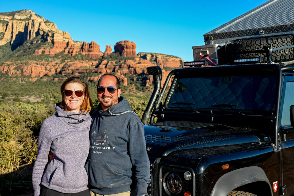
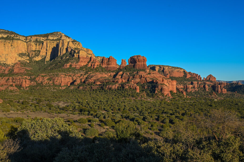
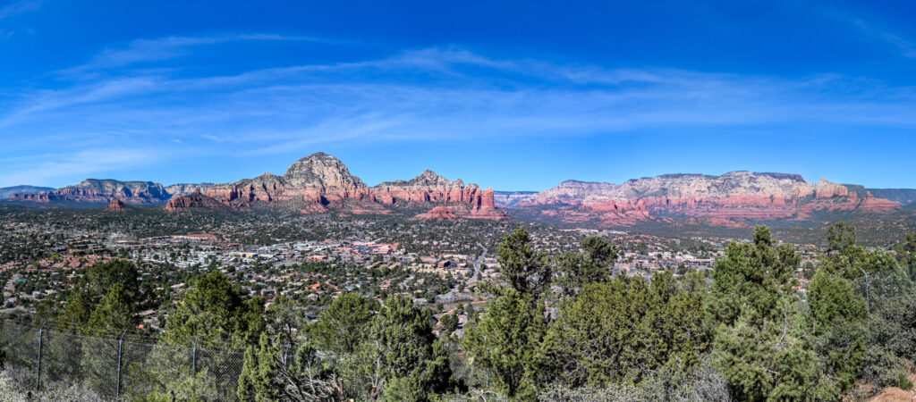
So, we have been told that the most beautiful place in the southwest is Sedona. It’s not quite right, because the red rocks in Red Rock State Park near Sedona are the star of the area. Wow, the lush red rocks are beautiful! There are the most spectacular views on the rocks. High above, a church has even been built into the rock, the Chapel of the Holy Cross. From there you have a good view of Sedona, the surrounding rocks and the Coconino National Forest, which surrounds the park. If you have time, you should definitely take the roads into the mountains, because the views not only on the rocks but also on the plain are simply stunning. We also drive a part of Schnebly Hill Road (FS Road 153), which connects AZ-179 with I-17 in summer and is about 19 km long. In winter, the road is only accessible up to the height of the pass. This is a real off-road track, unpaved, bumpy, with some deep holes and stones in the way and the most important thing: a breathtakingly beautiful view of the red rocks and nature. Not only we have fun, but also the countless jeep tours, which bump up and down the road with tourists.
In the surrounding Coconino National Forest or in the State Park itself, there are beautiful places to stay overnight, with views of the glowing red mountain ranges included.
Not far from Sedona is Jerome, an artist’s place on the hill above Cottonwood. Parking in Jerome is a bit of a challenge, because, as in any mountain village, parking spaces are scarce and parking meters are everywhere. There are two main streets lined with art galleries of all kinds (glass, jewellery, ceramics and much more) or just shops with clothes or leather goods. Otherwise, the village does not really live. It absolutely does not have the charm or flair of an artist’s place. It’s all designed for tourism. However, it is always worth seeing, especially the view of the valley is great. You should definitely visit the kaleidoscope shop. This is the largest in the world. There are the craziest things on kaleidoscopes.


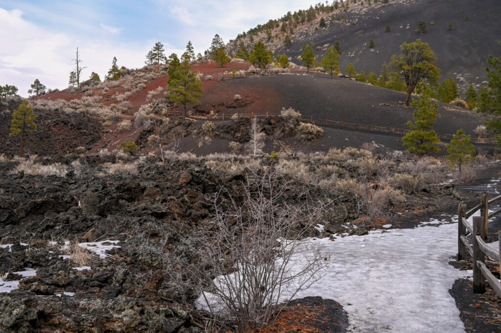
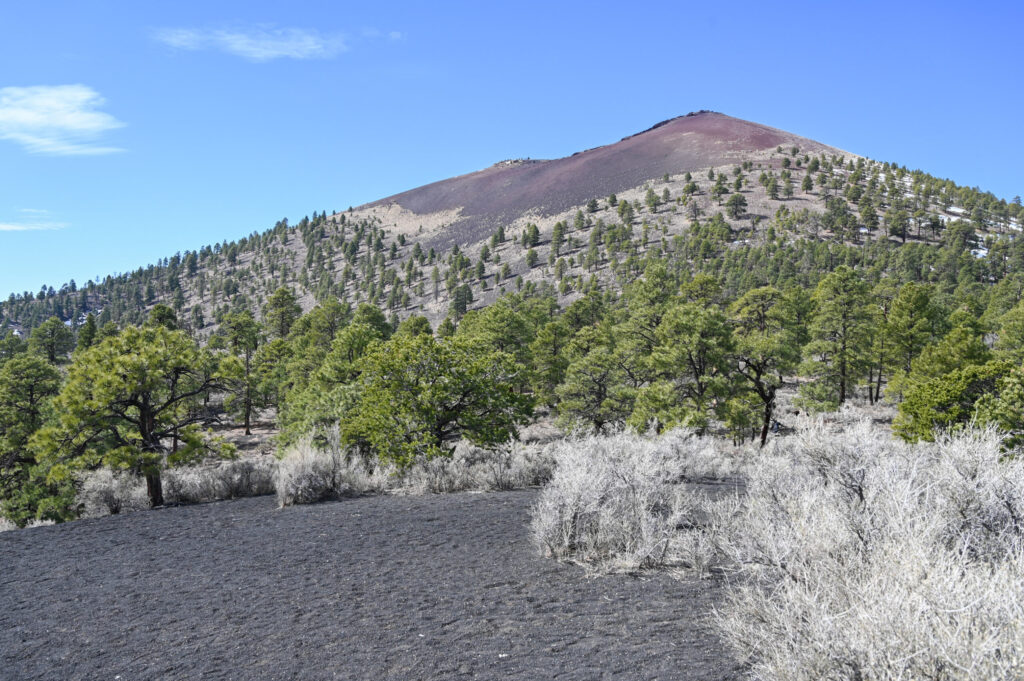
Since we should do oil service, we decide to do so in Flagstaff. We choose the beautiful route over 89A, which leads through the Coconino National Forest and is spiralling up slowly. At the highest point, a few Navajos sell their partially very beautiful art. From jewellery to small arrows to ritual vases, everything can be bought. We restrain ourselves, because you also need space to store the things safely. Freshly lubed (not us, only our Defender) we again take a more scenic route to Sunset Crater Volcano National Monument. The lava that has spilled can be admired at the side of the road and on the short lava trail. The black hills are special, some of which are still covered in snow. In the nearby forest there are countless places to stay. We choose one that is located in a small plain between two hills. As it gets dark and a starry night comes up, we think we are being watched by animals. There are eyes glowing in the distance, which we feel are getting closer and closer. Quickly into the camper, because who wants to be eaten by coyotes! The next morning, the mystery with the animal’s eyes is solved: they are signs with reflective numbers🙈. Greenhorns!
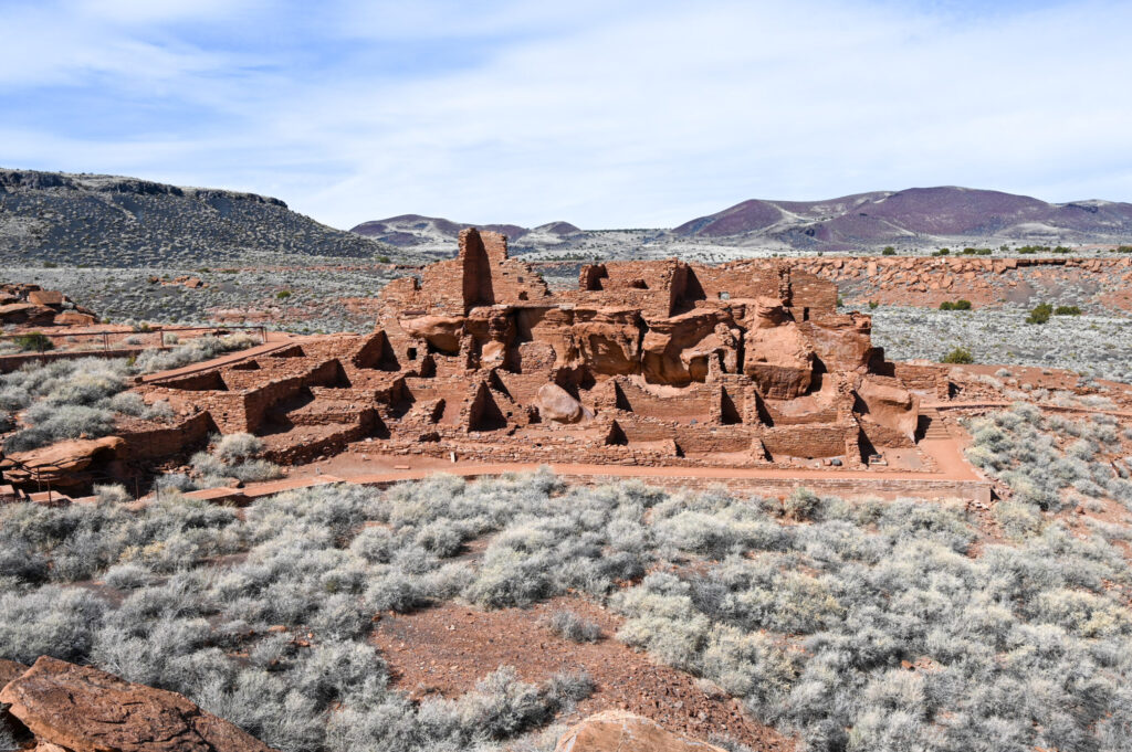
As the Wupatki National Monument is on our way, we take the opportunity to visit it. It is an abandoned Native American settlement (pueblo), which was built around the 12th century. In the Visitor Center we get a kind of map with information about the individual buildings. The highlight of this place is the building with the 100 rooms (a ruin of mud bricks, whose rooms served various purposes). At that time about 85 – 100 people lived in the village and thousands lived a day march away from it in other villages. A trade network was established between the various villages, in which exotic things such as turquoise, jewellery made of shells, copper bells and parrots were traded. Wupatki was the largest and probably the most influential village in the area and developed into a meeting place of different cultures. Around 1250 the inhabitants moved on and no one knows why. Wupatki isn’t exactly the most exciting National Monument we’ve visited, but if you’re in the area and want to see a few stone walls, go ahead.